Cargando...
Recursos educativos
-
Nivel educativo
-
Competencias
-
Tipología
-
Idioma
-
Tipo de medio
-
Tipo de actividad
-
Destinatarios
-
Tipo de audiencia
-
Creador
-

Wildlife and habitats
Tiching explorer Organización
- 1 lo usan
- 5994 visitas
In this website we find out about animals (amphibians, birds, bugs, dinosaurs, fish, invertebrates, mammals, reptiles) and habitats (antarctic, artic, forest, water, grassland, mountain). There are…
-

Average annual rainfall
EduBook Organización
- 2846 visitas
Precipitation maps have imaginary lines called isohyets. The isohyets connect places on the Earth's surface with the same amount of precipitation. The map shows how: Precipitation is abundant in…
-

Writing tips
Tiching explorer Organización
- 1 lo usan
- 5834 visitas
The resource consists of an explanation about how to write an essay. We study the process of writing an essay (planning, mind maps, writing a draft, etc.). The resource provides tips to write a good…
-

Can I surf this country?
Proyecto Agrega Organización
- 2 lo usan
- 3642 visitas
Didactic sequence designed to help us find out the geographical characteristics of different English-speaking countries. We learn to appreciate the importance of promoting the sustainable development of…
-

-

Directions
INTEF Organización
- 2 lo usan
- 2468 visitas
In this unit we ask for and give directions, follow maps, and describe a journey in London. We practice grammar (present perfect, degrees of certainty, modals, third conditional, simple present and…
-

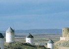
Travel routes in Spain: The Windmills Route. The Toledo area of La Mancha in
V&V Books Vicens Vives Organización
- 2226 visitas
Spain.info in english. Information about the travel route The Windmills Route. The Toledo area of La Mancha in Spain on the official website for tourism in Spain: destinations on the route The Windmills…
-

Internet Project
EduBook Organización
- 2021 visitas
In the original version of Gulliver’s Travels, Jonathan Swift printed maps to show where the imaginary islands of Lilliput and Blefuscu were. He did this to make his book seem more realistic. At the…
-

Learn. Reading a topographic map
EduBook Organización
- 1872 visitas
Topographic maps show the geographical relief of an area. Below is an example map (scale 1:25000) showing Matamorosa in Cantabria. Map reading guide The map key Look at the map key. Only the important…
-

Identify. Spain's relief and hydrography 02
EduBook Organización
- 1583 visitas
Look at these maps of the Iberian Peninsula and answer the questions: Which elements of relief can you see in each bloc? List the names of the rivers you can see in each bloc. Where is each sector…
Te estamos redirigiendo a la ficha del libro...


